


Know this place? Share your best photos of Åmot and help travelers discover Norway. Submit your photos →
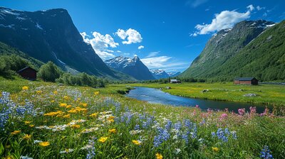
Åmot is Innlandet’s river-crossed forest basin — a municipality where conifer woods stretch toward Sweden, axes gleam in the coat of arms, and two mighty rivers meet beneath a bridge named for a local legend. With around 4,200 residents and a landscape shaped by the Glomma and Rena rivers, the Julussdalen valley, and the villages of Rena, Åsta, Osneset, and Snippen, Åmot is the kind of place where you can hike past husky farms, explore cobalt mines, and still sip spruce cordial beside a waterfall that once powered a pigment empire. It’s got rivers, ridges, and a name that means “river meeting.”
Top Attractions
- Korpreiret Gorge – dramatic canyon with waterfall views & hiking trails
- Raskiftet Wind Farm – scenic bike route with panoramic views
- Skydive Oslo – national parachute center offering tandem jumps & AFF courses
- Bergerloftet Museum – folk heritage museum with local crafts & history
- Julussdalen Valley – scenic drive through forested hills & historic farms
Unique Experiences
- Birken Mountain Bike Race – world’s largest MTB race from Rena to Lillehammer
- Rena Leir – military base with public events & historical significance
- Elvekryssing Trail – river crossing hike with wading & wild terrain
- Ellemitthølet Cave – mysterious rock fissure tied to local legends
- Rena Kulturhus – cultural center with cinema, concerts & exhibitions
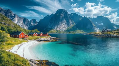
Where to Stay
Search hotels, cabins & guesthouses in Åmot
More searches: Booking.com · Hotels.com · Expedia · Agoda · Vrbo
Where to Eat
Explore top-rated restaurants in Åmot
Guided Tours
Search for guided tours in Åmot
Getting There
Åmot lies in Østerdalen, with Rena as its administrative center and Osneset as its lakeside heart. Reach it via Rv3 from Elverum or train to Rena Station. The area is best explored by boots, bike, or bold curiosity — especially if you’re chasing axe echoes, river lore, or the hush of pine needles beside a gorge carved by glacial melt.