
Know this place? Share your best photos of Lærdal and help travelers discover Norway. Submit your photos →
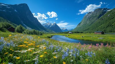
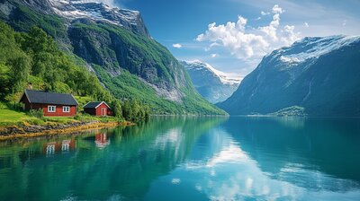
Lærdal is Vestland’s fjord-framed heritage corridor — a municipality where stave churches whisper medieval tales, salmon leap through glacier-fed rivers, and cobbled streets echo with market chants from centuries past. With around 2,100 residents and a landscape shaped by the Lustrafjorden, Lærdalselvi river, and the Kings Road over Filefjell, Lærdal is the kind of place where you can hike through UNESCO-listed valleys, kayak past waterfalls, and still catch a reindeer kebab beside Norway’s longest road tunnel. It’s got depth, drama, and a name that may stem from the river Lærr and Old Norse *dalr* — “valley.”
Top Attractions
- Borgund Stave Church – 12th-century wooden church with dragon heads & medieval carvings
- Vindhellavegen – scenic stone road with hairpin turns on the historic Kongevegen
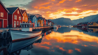
- Gamle Lærdalsøyri – old town with 161 protected wooden buildings from the 1700s
- Lærdal Tunnel – world’s longest road tunnel (24.5 km) linking Oslo and Bergen
- Norwegian Wild Salmon Centre – museum & aquarium showcasing salmon ecology
Unique Experiences
- Guided Walks on Kongevegen – hike through Galdane, Vindhella & Seltun with local stories
- Auga Sauna – Roman-inspired fjordside sauna & bathing complex
- Li-bab (Bonus: Guided tour) – local reindeer kebab with lingonberry sour cream & flatbread
- Tele- & Postal Museum – vintage phones, stamps & communication history
- Kayaking on Lærdalselvi – paddle past waterfalls & salmon pools
Where to Stay
Search hotels, cabins & guesthouses in Lærdal
More searches: Booking.com · Hotels.com · Expedia · Agoda · Vrbo
Where to Eat
Explore top-rated restaurants in Lærdal
Guided Tours
Search for guided tours in Lærdal
Getting There
Lærdal lies at the eastern end of the Sognefjord, with Lærdalsøyri as its administrative center. The E16 highway connects to Oslo and Bergen via the Lærdal Tunnel. Buses run to Borgund, Tønjum, and Aurland. The area is best explored by boots, boat, or bold curiosity — especially if you’re chasing stave silhouettes, salmon lore, or the hush of birch leaves beside a cobbled fjord town.