
Know this place? Share your best photos of Nordre Land and help travelers discover Norway. Submit your photos →
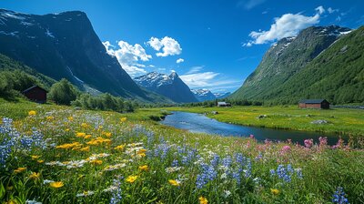
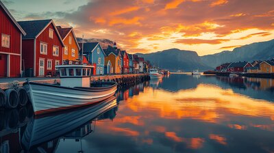
Nordre Land is Innlandet’s pine-framed valley basin — a municipality where glacier-carved peaks rise above wetland deltas, iron-age carvings decorate riverside rocks, and timber grapples mark the coat of arms. With around 6,500 residents and a landscape shaped by the Etna River, Randsfjorden, and the villages of Dokka, Torpa, and Hov, Nordre Land is the kind of place where you can hike past Red Cross cabins, cycle along old railway lines, and still catch a draisine ride beside a moose carving. It’s got grit, gentians, and a name that simply means “northern land.”
Top Attractions
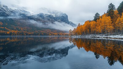
- Spåtind – 1414 m summit with panoramic views & alpine trails
- Åmot Church – 12th-century stone church with hillside cemetery
- Møllerstufossen – riverside rock carvings of moose & ancient symbols
- Kittilbu Utmarksmuseum – exhibits on alpine farming, elk hunting & bog iron
- Valdresbanen Draisine – pedal-powered rail trolleys along scenic tracks
Unique Experiences
- Liomseter DNT Cabin – staffed mountain hut open in summer & Easter
- Dokka Delta Wetlands – birdwatching hotspot with nature trails & observation towers
- Høgkampvannet Red Cross Cabin – rest stop for hikers & skiers near alpine lakes
- Flubergrunden Folk Trail – cycling route along the Etna River with cultural stops
- Halden Grapple History – learn about the iconic timber grapple featured in the coat of arms
Where to Stay
Search hotels, cabins & guesthouses in Nordre Land
More searches: Booking.com · Hotels.com · Expedia · Agoda · Vrbo
Where to Eat
Explore top-rated restaurants in Nordre Land
Guided Tours
Search for guided tours in Nordre Land
Getting There
Nordre Land lies north of Randsfjorden, with Dokka as its administrative center. The RV33 and RV250 highways provide access, and buses serve Torpa, Hov, and Fall. The area is best explored by boots, bike, or bold curiosity — especially if you’re chasing moose echoes, grapple lore, or the hush of birch leaves beside a Red Cross cabin.