


Know this place? Share your best photos of Os and help travelers discover Norway. Submit your photos →
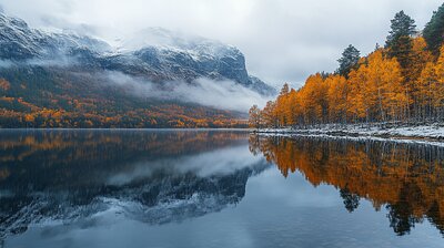
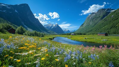
Os is Innlandet’s mountain-framed heritage basin — a municipality where cowbells echo through alpine valleys, rose-painted farmhouses line riverbanks, and stylized bells ring proudly on the coat of arms. With around 1,900 residents and a landscape shaped by the Glomma River, Hummelfjell peak, and the villages of Narjordet, Dalsbygda, and Tufsingdalen, Os is the kind of place where you can hike past glacier-carved eskers, explore schoolhouse museums, and still catch a husky ride beside a stave-style railway stop. It’s got folklore, fjells, and a name that means “river mouth.”
Top Attractions
- Oddentunet – 18th-century farm museum with rose-painted interiors & Trøndelag architecture
- Tufsingdal Nature Reserve – glacial esker trail with interpretive signs & wildlife
- Narbuvoll Old School – 1876 schoolhouse museum beside Narbuvoll Church
- Husky Point Røros – dog sledding tours through Os’s winter landscapes
- Dunder Adventures – rafting, biking & guided nature tours near Røros
Unique Experiences
- Hummelfjell Ski Centre – alpine slopes for families with views over Os valley
- Brofoss Hydropower Site – restored 1916 turbine station with historic exhibits
- Røbekken Grinding Mill – 1850s water-powered mill returned to its original site
- Håmmålvoll Railway Stop – 1915 Swiss-style station preserved by Os Museum
- Femund Lake Excursions – fishing, canoeing & berry-picking near Sweden border
Where to Stay
Search hotels, cabins & guesthouses in Os
More searches: Booking.com · Hotels.com · Expedia · Agoda · Vrbo
Where to Eat
Explore top-rated restaurants in Os
Guided Tours
Getting There
Os lies along County Road 30, about 15 minutes from Røros and its airport. Buses serve Narjordet, Tufsingdalen, and Dalsbygda. The Rørosbanen railway line passes nearby, and hiking trails connect to Forollhogna National Park. The area is best explored by boots, skis, or bold curiosity — especially if you’re chasing bell echoes, rose-painting lore, or the hush of birch leaves beside a schoolhouse museum.