
Know this place? Share your best photos of Nord-Aurdal and help travelers discover Norway. Submit your photos →
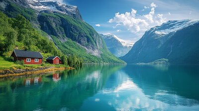
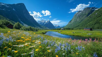
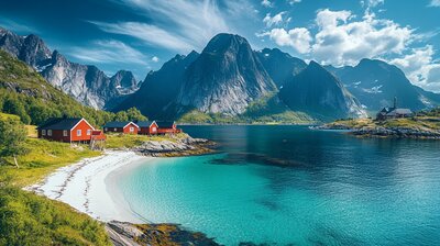
Nord-Aurdal is Innlandet’s alpine heritage basin — a municipality where folk museums overlook fjords, ski lifts rise above spruce forests, and blue gentian flowers bloom on the coat of arms. With around 6,400 residents and a landscape shaped by the Strondafjorden, Valdres Alps, and the villages of Fagernes, Aurdal, and Leira, Nord-Aurdal is the kind of place where you can hike past medieval churches, milk goats on summer farms, and still catch a concert beside a sculpture park. It’s got grit, gentians, and a name that means “northern valley of the gravel river.”
Top Attractions
- Valdres Folk Museum – open-air museum with 100+ historic buildings & folk music exhibits
- Valdres Alpinsenter – ski resort with alpine slopes, terrain park & fjord views
- Opplev Stølslivet – mountain farm experience with goat milking, cheese tasting & hiking
- Strandefjorden Fritidspark – lakeside activity park with Viking ship, water slides & hot tubs
- Fagernes Tourist Information – gateway to Valdres with maps, guides & local tips
Unique Experiences
- Bjørgovarden Hike – 7 km summit trail with panoramic views & gentle terrain
- Rognåstrøe Farm – traditional dairy farm with brown cheese, lambs & pigs
- Tingnes Church – 1972 modernist church with fjord backdrop & sculpture garden
- Valdres Golfklubb – scenic 18-hole course beside lakes & forest ridges
- Skrautvål Church – 1785 wooden church with hillside cemetery & folk art
Where to Stay
Search hotels, cabins & guesthouses in Nord-Aurdal
More searches: Booking.com · Hotels.com · Expedia · Agoda · Vrbo
Where to Eat
Explore top-rated restaurants in Nord-Aurdal
Guided Tours
Search for guided tours in Nord-Aurdal
Getting There
Nord-Aurdal lies along the E16 highway, with Fagernes as its administrative center and transport hub. Trains stop at nearby Lunde Station, and buses serve Aurdal, Leira, and Skrautvål. The area is best explored by boots, skis, or bold curiosity — especially if you’re chasing gentian echoes, folk lore, or the hush of birch leaves beside a stave church.